
Catalogue
Great Britain, Charles I (1625-49), legal document on vellum, written in Latin, with drawn Notary Mark in top left corner, two large wax seals, with signatures of Robert Drury, R.O. Tollermache and Edward Dunbar. Hole near top left corner and paper loss on folds, foxing and wear to writing, otherwise very good.
Estimate $120
Passed in
Great Britain, William and Mary, Last Will and Testament of John Poole of Glen ???bindson, County Berks, prepared on 4 December 1694, on vellum and with attached addendum document with five (V) shillings revenue stamp, signed by John Poole on 10 December 1694. Fine - very fine.
Estimate $250
SOLD $100
Great Britain, William III, legal document on vellum, 15th January 1694, with sixpence (VI) revenue stamp, signed by the parties with Samuel Kemble on the one side and on the other with the marks of Anthony (A) Ellie and Frances (F) Ellie front and back and with witnesses. Fine and scarce.
Estimate $200
SOLD $80
Great Britain, William III, Indenture Tripartite, 20th September 1695, written on vellum between William James and Thomas Duke of Yeoman and Elizabeth his wife and William James and John Ellis, a massive two page legal document signed by all parties and with multiple wax seals. Very fine.
Estimate $150
SOLD $70
Great Britain, Queen Anne (1702-14), Indenture on vellum for sale of land, 1710, elaborate drawn Royal crest in top left corner, sixpence (VI) revenue stamp, signed by Samuell White, Edward Stanford and John Michell. Fine.
Estimate $150
SOLD $70
Great Britain, King George I, Indenture on vellum, with Notary Mark drawn in top left corner, 20 March 1718, signed by the parties, Samuel Turner and John Parker and with other parties' marks, with multiple wax seals. Good fine.
Estimate $150
SOLD $70
Historische Remarques ber neuesten Sachen in Europa, 24 July 1703, p233 and reverse p240 of a printed and regularly published journal, the first page features an image and details of King Charles I English crown of 1645 with description, matted and framed under glass (approx 29x33cm), with journal page visible front and back. Journal paper toned, otherwise very fine.
Estimate $80
Passed in
World map, 1776, A Chart shewing (sic) The Track of the Centurion round the World, engraved by H. Gavin, features the course of Anson's world circumnavigation beginning in 1740 when he set sail in command of a squadron sent to attack Spanish possessions and interests in South America, lithograph matted and timber framed under glass (approx 57x39.5cm). A few scuffs on frame, lithograph has dropped slightly in frame exposing the unevenly cut top edge and tape used to hold it in position, foxing on edge of matting, otherwise very fine.
Estimate $80
Passed in
World map, 1782, A New Map of the World, Including All the Modern Discoveries, prepared Jan 1, 1782, features the northern and southern hemispheres as two globes, b&w lithograph matted and timber framed under glass (approx 53x37.5cm). A few scuffs on frame, otherwise very fine.
Estimate $80
Passed in
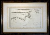
Van Diemen's Land chart, in b&w (approx 37.5x22.5cm), lithograph by T. Bowen, sculp., published in London c1793, features three coastal profiles namely, View of Van Diemen's Land over Fluted Cape, when South Cape bears NNE 1/2 E distant 7 miles; View of the Land over Fluted Cape when Penguin Island bears NWbW 1 1/2 mile distant; View of Van Diemen's Land when the Mewstone bears N 1/2 E distant 5 miles; this is a nautical chart of the coast of Tasmania from S.W. Cape to Maria's Isles showing the track of the Resolution on Captain Cook's third voyage in 1777 with relief shown pictorially and depth shown by bathymetric soundings, matted and framed under glass (approx 53x37cm). A few faint foxing spots on map and an edge tear on the border but not affecting the map, otherwise fine and scarce.
Estimate $300
Passed in
Carte Des Isles Britanniques, map of the British Isles with the kingdoms of England, Scotland and Ireland divided into provinces and counties, with supplement for the Orkney and Shetland Islands, by Robert De Vaugondy after Thomas Kitchin printed by C.F.Delamarch, undated (1800s), in colour, approx 53x71cm with 1.5x2.5cm borders. Foxing and two tears of 2cm on edge, otherwise very fine.
Estimate $30
Passed in
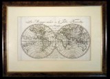
World map, La Mappe-monde ou le Globe Terrestre en deux Hemispheren Oriental & Occidental 1806 avec l'indication des Decouvertes de Cook, La Peyrouse (sic), Wilson et autres celebres Voyageurs (map of the world with the globe divided into two hemispheres, Oriental and Occidental, 1806, with an indication of the discoveries of Cook, La Perouse, Wilson and other celebrated travellers), map in colour (approx 33x20cm), shows Australia as New Holland with the lower right as Land of Diemen (now NSW and Victoria) and Tasmania as Island of Diemen, also shown is Botany Bay, matted and framed under glass (approx 47.5x35cm). Some foxing and folds, otherwise fine and scarce.
Estimate $200
SOLD $220
World maps, includes Australia pre 1900 with Hobart Town shown, by J. Archer, published by H.G. Collins; various country maps mostly in colour by S. Hall and published by A. & C. Black from the General Atlas of the World c1854, includes maps for Austrian Dominions, Brazil, Canada with New Brunswick &c, Chile La Plata and part of Bolivia, Columbia Peru &c, Denmark, Eastern Islands Birmah (sic) &c, Europe, France (2), Hellas (or Greece), Holland, Ireland, Italy, Italy south part with Malta and its Dependencies, Mexico California & Texas with Guatimala (sic), Netherlands, North America, Prussia, South America, Spain & Portugal, Sweden & Norway, Switzerland, Turkey in Asia, Turkey in Europe, United States, West Indies; later editions of Turkey in Asia by W. Hughes and Turkey in Europe by J.W. Lowry, both published by Blackie & Son. Stored in plastic sheets in a large (approx 36x44cm), blue three ring binder, the larger maps with tears or loss of paper at edges, some maps with toning, overall fine. (30)
Estimate $500
Passed in
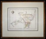
New South Wales map, (approx 34x26cm), published Jan 4 1828 by Samuel Arrowsmith, No. 10 Soho Square, London, features relief shown by hachures and spot heights, includes explorers' routes, also description of topography and boundaries of nine Counties in colour, matted and framed under glass (51x43cm). A few areas of light foxing, otherwise very fine and a scarce early Colonial map.
Estimate $500
Passed in
Van-Diemans Land map, (approx 35x42cm) in colour, drawn and engraved by J. Dower, Pentonville, London and published in London by Henry Teesdale & Co, 302 High Holborn, March 1831, matted and framed under glass (approx 52.5x60cm). A few small spots at bottom of map, otherwise very fine.
Estimate $100
Passed in
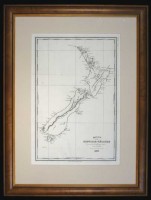
New Zealand map, Carte de la Nouvelle-Zelande pour servir au Voyage pittoresque autour du Monde par M. d'Urville 1835 (map of New Zealand for use in the scenic trip around the world by M. d'Urville in 1835), drawn and engraved by Ambroise Tardieu, in b&w (approx 23.5x34cm), shows north and south islands with Maori names of Ile Ika - Na - Mawi and Ile Tawai - Pounamou, matted and framed under glass (approx 39x51.5cm). A few spots of foxing and folds, otherwise very fine and scarce.
Estimate $400
Passed in
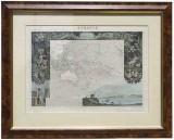
Oceanie map, (approx 45x32cm) in colour, engraved by William Laguillermie, illustrated by Raimond Bonheur Pientre, published by Lemercier, Paris c1847, depicts the Pacific voyage of Dumont d'Urville in the vessel Astrolabe and features his image and other scenes displayed around the central map, matted and framed under glass (approx 63x51cm). Very fine.
Estimate $200
SOLD $150
Map of southern Asia, Indian Ocean and the western side of Australia, this includes Colony of West Australia and Colony of North Australia, engraved by J. & C. Walker, published, London : Charles Knight, Jany 1st 1852, size (approx 34x41cm), in b&w with relief shown by hachures. Very fine.
Estimate $100
Passed in
Map of Australia, 1865-1870, (approx 41.5x30.7cm) published by Cassell, Petter & Galpin, La Belle Sauvage Yard, Ludgate Hill, E.C., showing explorers routes, counties, railways, rivers with notes on the topography and vegetation, in colour with relief shown by hachures; another in colour, c1884, (approx 41.5x30.7cm), drawn and engraved by Edwd Weller, Duke street, Bloomsbury and printed by Day & Son, lithographers to The Queen; also The Age newspaper, Colony of Victoria, Melbourne, Tuesday, October 17, 1854, No.1, Vol.1, facsimile edition probably issued to celebrate centenary of publication. Both maps with tears and paper loss around borders, the second with foxing along lines of removed sticky tape, otherwise fine, the newspaper with some toning, very fine. (3)
Estimate $80
Passed in
Australia map, in colour (approx 28.5x24cm), c1880, showing Alexandra Land and North Australia (these now both Northern Territory), and also Hobart Town (renamed Hobart in 1881) in Tasmania, map with raised surface for mountainous areas, double matted and framed under glass (approx 45x40.5cm). A few foxing spots on map and a few edge tears, otherwise fine.
Estimate $100
Passed in
Captain Cook's First Voyage lithograph, A Native of Otaheite, in the Dress of his Country, (approx 20.5x26.5cm), by S. Parkinson, engraved by R.B. Godfrey Sc., being plate 3 from Sydney Parkinson's expedition journal, 'A Journal of a Voyage to the South Seas, in His Majesty's Ship, the Endeavour, first published posthumously in 1773, matted and framed under glass (approx40.5x47cm). Foxing on print, otherwise very fine.
Estimate $70
Passed in
Captain Cook's First Voyage lithograph, A Woman & a Boy, Natives of Otaheite, in the Dress of that Country, (approx 20.5x26.5cm), by S. Parkinson, engraved by T. Chambers Sc., being plate 5 from Sydney Parkinson's expedition journal, 'A Journal of a Voyage to the South Seas, in His Majesty's Ship, the Endeavour, first published posthumously in 1773, matted and framed under glass (approx40.5x47cm). Foxing on print, otherwise very fine.
Estimate $70
Passed in
Captain Cook's Third Voyage lithograph, An Offering before Capt Cook, in the Sandwich Islands, by J. Webber, The Landscape Eng. By Middiman, The Figures by Hall, the drawing featuring the local inhabitants with Captain James Cook with some of his men assembled at a village meeting, lithograph in b&w (approx 38x24cm) and with frame (approx 57x42cm), matted and timber framed under UV protection glass. A few scrapes on frame, otherwise extremely fine.
Estimate $80
Passed in
Captain Cook's Third Voyage lithograph, The Reception of Captain Cook in Hapaee, (Tonga) by J. Webber, Heath sculp., the drawing featuring a gathering of local inhabitants in a circle watching a traditional combat match, with village structures, English sailors talking to village women and other daily routines of village life, lithograph in b&w (approx 39x24cm) and with frame (approx 57x42cm), matted and timber framed under UV protection glass. Very fine.
Estimate $80
Passed in
Captain Cook's Third Voyage lithograph, A Human Sacrifice, in a Morai, in Otaheite, by J. Webber, the drawing featuring Tahitians with Captain James Cook assembled at the sacrifical scene with some of his men, lithograph in b&w by W. Woollett, (approx 47.5x27cm) and with frame (approx 65x45cm), matted and timber framed under UV protection glass. Extremely fine.
Estimate $80
Passed in
Australian and New Zealand antique lithographs, c1880, hand coloured, includes four by Howard Willoughby and published by The Religious Tract Society, London in 1886, features A Native Climbing a Tree for Opossum, A Corroboree, Native Encampment, The Giant Gum-Tree, all approx 15x21.5cm and matted to approx size 33x28.5cm; also A Man of New Zealand/A Woman of New Zealand, c1880, in colour by Warren and published by Peter Jackson, London (approx 19.5x13.5cm) matted to approx size 32.5x28cm. First with light foxing spot, a few with foxing on border not affecting the image, otherwise extremely fine. (5)
Estimate $200
Passed in
Kangaroo chromolithographs, in colour on off-white pages (approx 24x30cm), from Proceedings of the Zoological Society of London, includes Plate XLIII, Dendrolagus Ursinus and Plate XLIV, Dendrolagus Ursinus (Type of D, Leucogenys matschie), drawn by F.W. Frohawk and printed by John Bale Sons & Danielsson, London. Toning and some creasing, otherwise very fine. (2)
Estimate $50
SOLD $40
Crimea lithographs, by Day & Son, lithographers to the Queen, drawn by William Simpson, published by, Paul Dominic Colnaghi & Co., London 1855, includes the following five items, Sebastopol From the East Or Extreme Right of English Attack; The New Works at the Siege of Sebastopol on the Right Attack; Distant View of Lord Raglan's Head Quarters Before Sebastopol; Redan and Advanced Trenches of British Right Attack; View From the Heights Above Balaklava, Looking Towards Sebastopol (Shewing (sic) the Ground of the Battle of the 25th Octr and of the 5th Novr 1854 and the Line of Our Defences Since the 25th Octr), all approx 45x28cm excluding borders and in colour. Edge tears and some loss of paper to white borders not affecting the image, foxing and some with water stains, otherwise fine and scarce. (5)
Estimate $100
Passed in
Corra Lynn, Tasmania, hand coloured engraving, c1887, (approx 15.5x13.5cm), matted to approx size of 26x25cm; also a mountainside lake scene in colour, c1879 printed on parchment (27x18.5cm). Small spot of foxing near edge and other light marking on first, otherwise very fine, the second extremely fine. (2)
Estimate $50
SOLD $30
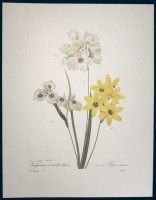
Antique botanical flower prints, by Pierre-Joseph Redoute, c1950s from his original folio titled Choix des Plus Belles Fleurs et des Plus Beaux Fruits published in 1827, includes nos 3, 4, 7, 13, 35, 44, 45, 58-60, 66, 70, 73, 89, 96, 97, 120-122, 124, 125, 127, 128, 131, 132, 141, 142, 144. Good extremely fine. (28)
Estimate $500
Passed in