Lot 3976
Sale 108 · Important Australian & World Coins, Tokens, Medals & Banknotes
Images
Description
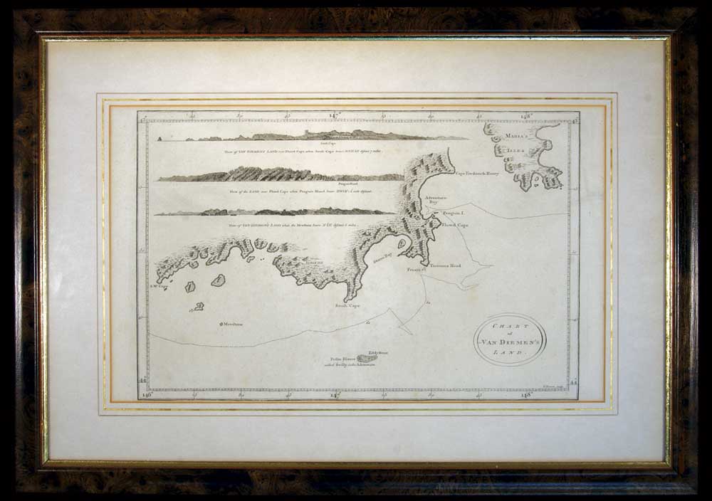
Van Diemen's Land chart, in b&w (approx 37.5x22.5cm), lithograph by T. Bowen, sculp., published in London c1793, features three coastal profiles namely, View of Van Diemen's Land over Fluted Cape, when South Cape bears NNE 1/2 E distant 7 miles; View of the Land over Fluted Cape when Penguin Island bears NWbW 1 1/2 mile distant; View of Van Diemen's Land when the Mewstone bears N 1/2 E distant 5 miles; this is a nautical chart of the coast of Tasmania from S.W. Cape to Maria's Isles showing the track of the Resolution on Captain Cook's third voyage in 1777 with relief shown pictorially and depth shown by bathymetric soundings, matted and framed under glass (approx 53x37cm). A few faint foxing spots on map and an edge tear on the border but not affecting the map, otherwise fine and scarce.
- Estimate
- $300
- Result Status
- Passed in