
Catalogue
Great Britain, Game Duty Certificate D, for a person not being a Game-keeper, for the year 1825 for the Division of Gore in the County of Middlesex, issued to The Rev William Drury residing in the Parish of Harrow on the Hill in the said County, signed by William S. Tootell, Clerk to the Commissioner for Taxes; also Appointment Document of George III, with one pound ten shillings duty stamp affixed, all details faded to near invisible. Good very fine; good. (2)
Estimate $100
Passed in
Great Britain Conveyance, of a plot of land at Cliff-Bank in the Parish of Stoke upon Trent in the County of Stafford from F.W.Tomlinson Esquire to Mr Richard Davis and his Trustee, dated 23rd and 25th of March 1839, signed and witnessed, with relevant duty stamps, all on parchment. Fine.
Estimate $70
Passed in
Weekly Dispatch newspapers, published at 139 Fleet Street, London, edition 2754 Sunday Oct 8, 1854, edition 2755 Sunday Oct 15, 1854 and edition 2761 Sunday Nov 26, 1854 + Supplement. Creases folds, toning, loss of paper around edges, very good. (4)
Estimate $40
Passed in
Territory of New South Wales, Land Grant by Purchase of a Town Allotment by auction in the town of Broulee, County of St Vincent, by William Hindson and Henry Eldred Hindson, on vellum, signed and sealed by Governor Sir George Gipps, 31st March 1841. With folds and some foxing on bottom edge, good very fine.
Estimate $100
SOLD $80
Colony of Victoria, Leases, for premises in Brunswick Street, Collingwood, between William Middleton Tennent and James Blackburn, 7th October 1853; another, between Francis Bryant and William Middleton Tennent, 9th September 1852; 15 year lease between James Westwood and William Trollope, 10th July 1850; between William Trollope and Francis Bryant, 10th January 1852, first, second and third handwritten on vellum. With some foxing, very fine. (4)
Estimate $100
SOLD $80
Colony of Victoria, Lease of Land, of two hundred and seventy eight acres and twenty six perches of agricultural land in the County of Dundas, Parish of Redruth to Thomas McKnight Hamilton, overseer of Belfast, on vellum, signed and sealed by Sir Charles Henry Darling, 23rd August 1865. Good very fine.
Estimate $100
SOLD $80
Colony of Victoria, Land Grant by Purchase, of twenty two acres and two roods in the County of Bourke, Parish of Bulla Bulla to Arthur Mallow of Bulla, on vellum, signed and sealed by Governor John Henry Thomas Viscount Canterbury, 13th August 1872. Good very fine.
Estimate $100
SOLD $170
Colony of Victoria, Land Grant by Purchase, of one hundred and twelve acres two roods in the County of Grenville, Parish of Wurrook to Thomas Russell of Inverleigh, on vellum, signed and sealed by Governor Sir Henry Barkly, 13th May 1862; together with conveyance for part of the land to William Elder, dated 31st December 1866. Good very fine. (2)
Estimate $100
SOLD $80
Colony of Victoria, Grant of Watercourse, on land in Carlton, between Patrick Sheil and Christopher Joseph Glynn both of Carlton, handwritten on vellum, 13th April 1866; Certificate of Title, on a parcel of land in the Parish of Mildura, to Henry Rix, 4th May 1891, on vellum, with a one pound duty stamp affixed; Mortgage of land, in the Parishes of Lexington and Moyston, between William Durham Clarke of Lexington and The Honourable Sir William John Clarke of Rupertswood, Sunbury, 15th June 1894, with one penny duty stamp affixed. Very fine - extremely fine. (3)
Estimate $150
SOLD $180
USA, Copy of the Charter of the T.C.Williams Company, signed and sealed by Joseph T Lawless secretary of the Commonwealth of Virginia, with attached certification with detached seal and ribbon of Chas. T.O'Ferral Governor of Virginia, 1st February 1894; Extract from Deed of Conveyance (2), in relation to the firm of Thomas C Williams & Co, 30th July 1894; Extract from the By Laws of the T.C.Williams Company, 31st May 1890; letters (2) regarding trade marks, 2nd July 1894; Minutes regarding apointment of W.H.Calder of Melbourne (Australia) as agent for the Company in Australia, 2nd November 1891. With some foxing, fine - good very fine. (7)
Estimate $100
Passed in
Historische Remarques ber neuesten Sachen in Europa, 24 July 1703, p233 and reverse p240 of a printed and regularly published journal, the first page features an image and details of King Charles I English crown of 1645 with description, matted and framed under glass (approx 29x33cm), with journal page visible front and back. Journal paper toned, otherwise very fine.
Estimate $60
Passed in
Captain Cook's First Voyage lithograph, A Native of Otaheite, in the Dress of his Country, (approx 20.5x26.5cm), by S. Parkinson, engraved by R.B. Godfrey Sc., being plate 3 from Sydney Parkinson's expedition journal, 'A Journal of a Voyage to the South Seas, in His Majesty's Ship, the Endeavour, first published posthumously in 1773, matted and framed under glass (approx40.5x47cm). Foxing on print, otherwise very fine.
Estimate $50
Passed in
Captain Cook's First Voyage lithograph, A Woman & a Boy, Natives of Otaheite, in the Dress of that Country, (approx 20.5x26.5cm), by S. Parkinson, engraved by T. Chambers Sc., being plate 5 from Sydney Parkinson's expedition journal, 'A Journal of a Voyage to the South Seas, in His Majesty's Ship, the Endeavour, first published posthumously in 1773, matted and framed under glass (approx40.5x47cm). Foxing on print, otherwise very fine.
Estimate $50
Passed in
Captain Cook's Third Voyage lithograph, A Human Sacrifice, in a Morai, in Otaheite, by J. Webber, the drawing featuring Tahitians with Captain James Cook assembled at the sacrifical scene with some of his men, lithograph in b&w by W. Woollett, (approx 47.5x27cm) and with frame (approx 65x45cm), matted and timber framed under UV protection glass. Extremely fine.
Estimate $60
Passed in
Captain Cook's Third Voyage lithograph, An Offering before Capt Cook, in the Sandwich Islands, by J. Webber, The Landscape Eng. By Middiman, The Figures by Hall, the drawing featuring the local inhabitants with Captain James Cook with some of his men assembled at a village meeting, lithograph in b&w (approx 38x24cm) and with frame (approx 57x42cm), matted and timber framed under UV protection glass. A few scrapes on frame, otherwise extremely fine.
Estimate $60
Passed in
Captain Cook's Third Voyage lithograph, The Reception of Captain Cook in Hapaee, (Tonga) by J. Webber, Heath sculp., the drawing featuring a gathering of local inhabitants in a circle watching a traditional combat match, with village structures, English sailors talking to village women and other daily routines of village life, lithograph in b&w (approx 39x24cm) and with frame (approx 57x42cm), matted and timber framed under UV protection glass. Very fine.
Estimate $60
Passed in
World map, 1776, A Chart shewing (sic) The Track of the Centurion round the World, engraved by H. Gavin, features the course of Anson's world circumnavigation beginning in 1740 when he set sail in command of a squadron sent to attack Spanish possessions and interests in South America, lithograph matted and timber framed under glass (approx 57x39.5cm). A few scuffs on frame, lithograph has dropped slightly in frame exposing the unevenly cut top edge and tape used to hold it in position, foxing on edge of matting, otherwise very fine.
Estimate $60
SOLD $160
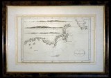
Van Diemen's Land chart, in b&w (approx 37.5x22.5cm), lithograph by T. Bowen, sculp., published in London c1793, features three coastal profiles namely, View of Van Diemen's Land over Fluted Cape, when South Cape bears NNE 1/2 E distant 7 miles; View of the Land over Fluted Cape when Penguin Island bears NWbW 1 1/2 mile distant; View of Van Diemen's Land when the Mewstone bears N 1/2 E distant 5 miles; this is a nautical chart of the coast of Tasmania from S.W. Cape to Maria's Isles showing the track of the Resolution on Captain Cook's third voyage in 1777 with relief shown pictorially and depth shown by bathymetric soundings, matted and framed under glass (approx 53x37cm). A few faint foxing spots on map and an edge tear on the border but not affecting the map, otherwise fine and scarce.
Estimate $200
SOLD $220
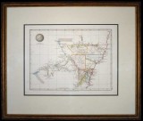
New South Wales map, (approx 34x26cm), published Jan 4 1828 by Samuel Arrowsmith, No. 10 Soho Square, London, features relief shown by hachures and spot heights, includes explorers' routes, also description of topography and boundaries of nine Counties in colour, matted and framed under glass (51x43cm). A few areas of light foxing, otherwise very fine and a scarce early Colonial map.
Estimate $350
Passed in
Carte Des Isles Britanniques, map of the British Isles with the kingdoms of England, Scotland and Ireland divided into provinces and counties, with supplement for the Orkney and Shetland Islands, by Robert De Vaugondy after Thomas Kitchin printed by C.F.Delamarch, undated (1800s), in colour, approx 53x71cm with 1.5x2.5cm borders. Foxing and two tears of 2cm on edge, otherwise very fine.
Estimate $30
Passed in
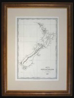
New Zealand map, Carte de la Nouvelle-Zelande pour servir au Voyage pittoresque autour du Monde par M. d'Urville 1835 (map of New Zealand for use in the scenic trip around the world by M. d'Urville in 1835), drawn and engraved by Ambroise Tardieu, in b&w (approx 23.5x34cm), shows north and south islands with Maori names of Ile Ika - Na - Mawi and Ile Tawai - Pounamou, matted and framed under glass (approx 39x51.5cm). A few spots of foxing and folds, otherwise very fine and scarce.
Estimate $280
Passed in
Map of southern Asia, Indian Ocean and the western side of Australia, this includes Colony of West Australia and Colony of North Australia, engraved by J. & C. Walker, published, London : Charles Knight, Jany 1st 1852, size (approx 34x41cm), in b&w with relief shown by hachures. Very fine.
Estimate $70
Passed in
Crimea lithographs, by Day & Son, lithographers to the Queen, drawn by William Simpson, published by, Paul Dominic Colnaghi & Co., London 1855, includes the following five items, Sebastopol From the East Or Extreme Right of English Attack; The New Works at the Siege of Sebastopol on the Right Attack; Distant View of Lord Raglan's Head Quarters Before Sebastopol; Redan and Advanced Trenches of British Right Attack; View From the Heights Above Balaklava, Looking Towards Sebastopol (Shewing (sic) the Ground of the Battle of the 25th Octr and of the 5th Novr 1854 and the Line of Our Defences Since the 25th Octr), all approx 45x28cm excluding borders and in colour. Edge tears and some loss of paper to white borders not affecting the image, foxing and some with water stains, otherwise fine and scarce. (5)
Estimate $70
SOLD $50
Map of Australia, 1865-1870, (approx 41.5x30.7cm) published by Cassell, Petter & Galpin, La Belle Sauvage Yard, Ludgate Hill, E.C., showing explorers routes, counties, railways, rivers with notes on the topography and vegetation, in colour with relief shown by hachures; another in colour, c1884, (approx 41.5x30.7cm), drawn and engraved by Edwd Weller, Duke street, Bloomsbury and printed by Day & Son, lithographers to The Queen; also The Age newspaper, Colony of Victoria, Melbourne, Tuesday, October 17, 1854, No.1, Vol.1, facsimile edition probably issued to celebrate centenary of publication. Both maps with tears and paper loss around borders, the second with foxing along lines of removed sticky tape, otherwise fine, the newspaper with some toning, very fine. (3)
Estimate $60
SOLD $40
Australia map, in colour (approx 28.5x24cm), c1880, showing Alexandra Land and North Australia (these now both Northern Territory), and also Hobart Town (renamed Hobart in 1881) in Tasmania, map with raised surface for mountainous areas, double matted and framed under glass (approx 45x40.5cm). A few foxing spots on map and a few edge tears, otherwise fine.
Estimate $70
Passed in
Australian and New Zealand antique lithographs, c1880, hand coloured, includes four by Howard Willoughby and published by The Religious Tract Society, London in 1886, features A Native Climbing a Tree for Opossum, A Corroboree, Native Encampment, The Giant Gum-Tree, all approx 15x21.5cm and matted to approx size 33x28.5cm; also A Man of New Zealand/A Woman of New Zealand, c1880, in colour by Warren and published by Peter Jackson, London (approx 19.5x13.5cm) matted to approx size 32.5x28cm. First with light foxing spot, a few with foxing on border not affecting the image, otherwise extremely fine. (5)
Estimate $140
Passed in
World maps, includes Australia pre 1900 with Hobart Town shown, by J. Archer, published by H.G. Collins; various country maps mostly in colour by S. Hall and published by A. & C. Black from the General Atlas of the World c1854, includes maps for Austrian Dominions, Brazil, Canada with New Brunswick &c, Chile La Plata and part of Bolivia, Columbia Peru &c, Denmark, Eastern Islands Birmah (sic) &c, Europe, France (2), Hellas (or Greece), Holland, Ireland, Italy, Italy south part with Malta and its Dependencies, Mexico California & Texas with Guatimala (sic), Netherlands, North America, Prussia, South America, Spain & Portugal, Sweden & Norway, Switzerland, Turkey in Asia, Turkey in Europe, United States, West Indies; later editions of Turkey in Asia by W. Hughes and Turkey in Europe by J.W. Lowry, both published by Blackie & Son. Stored in plastic sheets in a large (approx 36x44cm), blue three ring binder, the larger maps with tears or loss of paper at edges, some maps with toning, overall fine. (30)
Estimate $350
Passed in
Van Diemen's Land, handwritten two page letter and accompanying two page statement, from Police Office Hobart, dated 7th April 1834 to the Police Magistrate for Richmond, concerning a prisoner John Pearce, an absentee from the Grass Tree Hill Road Party and his written statement relative to the men now in custody at Richmond, charged with the robbery at Mr Sharpes. The statement given by John Pearce details the robbery committed by a John Shepherd posing as a police constable and telling the property owner, Mr Sharpes that he had heard bushrangers were there. The statement describes in detail how Mr Shepherd and four others had obtained the goods and who they later sold them to. The items stolen included a fowling piece, a musket, tablecloth, shawl handkerchief, a bedsheet and spyglass. A very interesting and early account of a criminal action in Van Diemen's Land. Small holes in centre fold on first page, also five minor tears to edges, very fine, well preserved and quite legible.
Estimate $200
SOLD $250
Van Diemen's Land, Charge Sheet on parchment dated 15 January 1842, made by Attorney General Thomas Welsh, stating that Richard Singleton, labourer, did steal one gun, a pair of trousers and one shirt being the goods of Robert Johnston, signed by Thomas Welsh, at the left edge is marked, 'Plea not Guilty' and on the reverse is written, 'Found Not Guilty'. Very fine.
Estimate $100
Passed in
Van Diemen's Land, letter dated 14 March 1849 from Roderick McDonald, in H.M. Gaol, Richmond, to Mr Young, Female Hiring Depot at Ross requesting that the recipient forward on his letter, in which he states he has been in prison for 16 weeks and is totally penniless and unable to pay the fine of ten pounds, together with a recommendation by Mr Young, the instigator of the charge against McDonald, that he be released from prison; also letter dated 20 March 1849 from said Mr Young to the Chief Police Magistrate, Hobart making such a recommendation for issuing an Order to Richmond Gaol for the release of Mr McDonald. Ragged edge on second letter where the page has been torn from a book, otherwise fine - very fine. (2 letters)
Estimate $150
Passed in