Lot 1279
Sale 128 · Important Australian, British, World, and Ancient Coins, Banknotes, and Medals
Images
Description
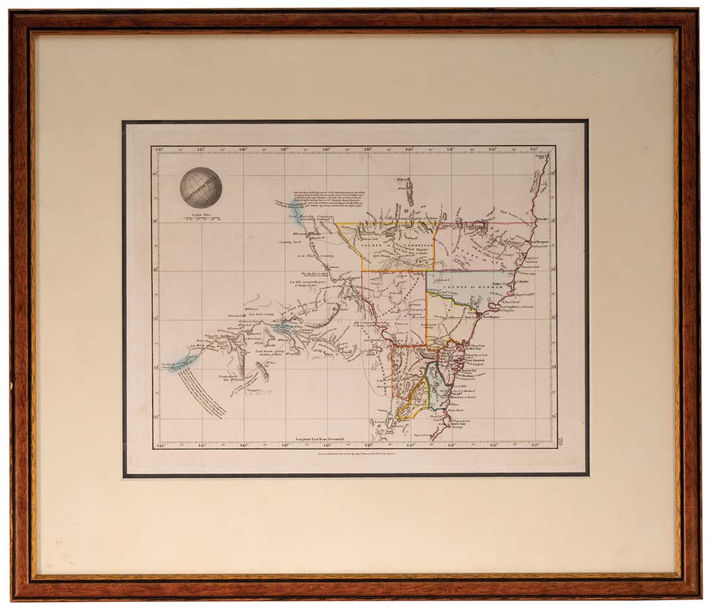
New South Wales map, (approx 34x26cm), published Jan 4 1828 by Samuel Arrowsmith, No. 10 Soho Square, London, features relief shown by hachures and spot heights, includes explorers' routes, also description of topography and boundaries of nine Counties in colour, matted and framed under glass (51x43cm). A few areas of light foxing, otherwise very fine and a scarce early Colonial map.
- Estimate
- $350
- Result Status
- Sold
- Prices Realised
- $280